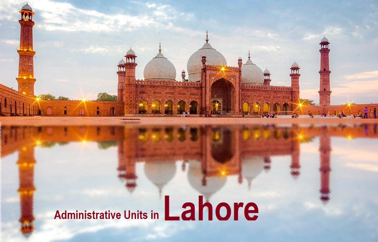
Lahore, the capital of Punjab and the second-largest city in Pakistan, is a metropolis that boasts a rich cultural heritage and a complex administrative structure. Understanding the geographical boundaries of Lahore is crucial for various stakeholders, including policymakers, urban planners, and residents. This overview delves into the administrative and political divisions that define Lahore, highlighting its national and provincial assembly constituencies, tehsils, zones, and union councils.
The geographical boundaries of Lahore are essential for effective governance and resource allocation. Lahore is divided into multiple administrative segments, each serving specific functions and responsibilities. These divisions are not just important for administrative purposes but also play a vital role in the political landscape of the region. The national and provincial assembly constituencies outline the electoral districts used during elections, ensuring that representation in the legislative bodies is proportionate and reflective of the population’s needs.
Tehsils, or sub-districts, further subdivide the city for administrative efficiency. Lahore comprises several tehsils, each governed by a Tehsil Municipal Administration (TMA). These TMAs are responsible for local development projects, infrastructure maintenance, and public services, catering to the unique needs of their respective areas. The tehsil boundaries often align with the broader zones, which serve as higher-level administrative units within the city.
Zones in Lahore are designed to streamline governance by grouping multiple tehsils under a single administrative umbrella. These zones facilitate coordinated efforts for urban planning, traffic management, and emergency services, ensuring that the city’s growth and development are systematically managed. Furthermore, the union councils at the grassroots level play a critical role in local governance. Each union council represents a smaller community within a tehsil, providing a direct link between the citizens and their local government.
In essence, the intricate network of national and provincial assembly constituencies, tehsils, zones, and union councils forms the backbone of Lahore’s administrative framework. This structure not only aids in efficient governance but also ensures that the diverse needs of Lahore’s population are met through targeted and localized interventions.
National Assembly Constituencies in Lahore
Lahore, the cultural heart of Pakistan, is divided into several National Assembly constituencies, each representing a distinct geographical area within the city. These constituencies range from NA-117 (Lahore-I) to NA-130 (Lahore-XIV), ensuring comprehensive representation for Lahore’s diverse population. Below is an overview of each constituency, highlighting their geographical boundaries and key landmarks.
NA-117 (Lahore-I): This constituency encompasses areas such as Shahdara and parts of Ravi. It is known for its historical significance, including landmarks like the Badshahi Mosque and the Lahore Fort.
NA-118 (Lahore-II): Covering the region of Shalimar and parts of Kot Khawaja Saeed, NA-118 is a mix of residential and commercial zones. The Shalimar Gardens, a UNESCO World Heritage site, is a notable landmark here.
NA-119 (Lahore-III): This constituency includes areas such as Samanabad and Ichhra. It is characterized by busy marketplaces and educational institutions, with the historic Ichhra Bazaar being a significant feature.
NA-120 (Lahore-IV): Encompassing the areas of Mozang and Anarkali, NA-120 is a blend of cultural heritage and bustling commercial activity. The Anarkali Bazaar is one of the oldest surviving markets in South Asia.
NA-121 (Lahore-V): This constituency covers parts of Sanda and Bilal Gunj. It is known for its vibrant community life and includes several important public spaces.
NA-122 (Lahore-VI): Comprising the areas of Defence Housing Authority (DHA) and Cantt, NA-122 is one of the more affluent constituencies in which Imran Khan (Former Ministerial of Pakistan & Chairmain Pakistan Tehrik e Insaf) defeated Khawaja Saad Rafique during 2018 elections, known for its planned residential communities and commercial hubs.

NA-123 (Lahore-VII): This constituency includes the regions of Mian Meer and parts of Harbanspura. It features a mix of urban and semi-urban landscapes. Mian Muhammad Shehbaz Sharif won from this constituency during elections 2024, and became prime minister of Pakistan

NA-124 (Lahore-VIII): Covering the areas of Baghbanpura and Mughalpura, NA-124 is known for its historical gardens and bustling localities.
NA-125 (Lahore-IX): Encompassing Gulberg and parts of Model Town, this constituency is characterized by its commercial centers and upscale residential areas.
NA-126 (Lahore-X): This constituency includes parts of Johar Town and Township. It is a blend of educational institutions, residential communities, and commercial zones.
NA-127 (Lahore-XI): Covering areas like Green Town and Wapda Town, NA-127 is primarily residential, with several parks and community centers.
NA-128 (Lahore-XII): This constituency includes parts of Raiwind and Chuhng, known for their agricultural landscapes and suburban feel.
NA-129 (Lahore-XIII): Encompassing regions of Allama Iqbal Town and adjacent areas, NA-129 is characterized by its educational institutions and vibrant marketplaces.
NA-130 (Lahore-XIV): This constituency covers parts of Walton and Nishter Town. It is a mix of industrial zones, residential areas, and commercial activities.
Each National Assembly constituency in Lahore plays a crucial role in the city’s representation at the national level, reflecting the diverse socio-economic and cultural fabric of this historic metropolis.
Provincial Assembly Constituencies in Lahore
Lahore, the capital city of Punjab, is divided into several provincial assembly constituencies, each with its unique geographical boundaries and characteristics. The constituencies are numbered from PP-144 (Lahore-I) to PP-173 (Lahore-III), reflecting the diverse and vibrant political landscape of the city.
Starting with PP-144 (Lahore-I), this constituency covers areas such as Garhi Shahu, Davis Road, and parts of Mall Road. It is a mix of commercial and residential zones, representing a blend of middle-class and upper-middle-class demographics. Moving to PP-145 (Lahore-II), the constituency includes regions like Mozang and Ichhra, both known for their bustling markets and dense population.
As we progress to PP-146 (Lahore-III) and PP-147 (Lahore-IV), these constituencies encompass localities such as Samanabad and Gulshan-e-Ravi, respectively. Samanabad is characterized by its educational institutions and residential colonies, while Gulshan-e-Ravi is a well-planned area with a significant number of residential blocks and commercial areas.
Further, PP-148 (Lahore-V) includes parts of Model Town and Faisal Town, regions known for their planned infrastructure and affluent residents. Meanwhile, PP-149 (Lahore-VI) covers Johar Town, a rapidly developing region with numerous housing schemes and commercial setups.
The constituencies from PP-150 (Lahore-VII) to PP-173 (Lahore-VIII) span across various other parts of Lahore, including densely populated areas like Shadman, Allama Iqbal Town, and Cantt. PP-159 Lahore-XV is the most prominent constituency during 2024 elections, from where Maryam Nawaz Sharif won and became the chief minister of Punjab. These regions exhibit a wide range of socio-economic characteristics, from high-end residential areas to more economically diverse neighborhoods.

Each constituency in Lahore plays a crucial role in the provincial assembly, reflecting the city’s complex demographic and political fabric. The geographical boundaries of these constituencies are carefully delineated to ensure fair representation, although they are subject to change based on population shifts and administrative decisions.
Tehsils of Lahore District
The Lahore District is administratively divided into five tehsils: Lahore Cantt, Lahore City, Model Town, Raiwind, and Shalimar. Each tehsil holds unique geographical boundaries and administrative significance, contributing to the overall governance and functionality of Lahore.
Lahore Cantt
Lahore Cantt, or Cantonment, is located in the eastern part of Lahore. It is primarily known for its military establishments and high-security zones. The tehsil encompasses areas such as DHA (Defence Housing Authority) and Walton. Besides its strategic importance, Lahore Cantt also features residential and commercial zones, making it a vital part of the city’s infrastructure.
Lahore City
Lahore City tehsil, often referred to as the heart of Lahore, includes the old walled city and surrounding areas. This tehsil is the cultural and historical hub, featuring landmarks such as the Lahore Fort, Badshahi Mosque, and the bustling markets of Anarkali and Liberty. The densely populated area is a blend of historical architecture and modern urban development, making it a focal point for both administration and tourism.
Model Town
Model Town tehsil is prominently recognized for its well-planned residential colonies and educational institutions. Located in the southwestern part of Lahore, it includes areas like Faisal Town, Garden Town, and Township. Known for its organized layout and green spaces, Model Town provides a serene urban living experience. It also hosts several commercial centers, adding to its administrative importance.
Raiwind
Raiwind tehsil, situated on the outskirts of Lahore, is renowned for its agricultural lands and religious significance. The area is home to the annual Raiwind Tablighi Ijtema, a large Islamic congregation. Raiwind is also experiencing rapid urbanization with new housing schemes and industrial zones, marking its transition from a predominantly rural area to a more urbanized region.
Shalimar
Shalimar tehsil, located in the northeastern part of Lahore, derives its name from the famous Shalimar Gardens. This tehsil is a mix of historical sites and modern urban development. Areas such as Mughalpura and Harbanspura fall within its jurisdiction. Shalimar tehsil is known for its educational institutions and healthcare facilities, playing a crucial role in the district’s administration and public services.
Zones of Lahore
Lahore, the cultural heart of Pakistan, is administratively divided into nine distinct zones. These zones are pivotal in maintaining the city’s governance, infrastructural development, and service delivery. Each zone has its own unique characteristics, contributing to the rich tapestry of Lahore’s urban landscape.
The Ravi Zone is named after the River Ravi, which flows along the northwestern boundary of Lahore. This zone is a mix of urban and rural areas, reflecting both the historical significance and modern development of the city.
The Shalamar Zone is renowned for the historic Shalimar Gardens, a UNESCO World Heritage site. This zone is densely populated and is a key area for residential and commercial activities.

The Wagha Zone, bordering India, is famous for the Wagha Border ceremony. This zone includes several rural localities and serves as a crucial border crossing point between Pakistan and India.
The Aziz Bhatti Zone is named after Major Aziz Bhatti, a national hero. It comprises various residential neighborhoods and is known for its educational institutions and healthcare facilities.
The Data Ganj Bakhsh Zone is named after the famous Sufi saint, Data Ganj Bakhsh. This central zone is a bustling hub of commercial activities, historical sites, and cultural landmarks.
The Gulberg Zone is one of the most affluent areas in Lahore, characterized by upscale residential localities, commercial centers, and entertainment venues. It is a prime area for business and leisure.
The Samnabad Zone is predominantly residential but also houses several educational and healthcare institutions. It is known for its vibrant community life and local markets.
The Allama Iqbal Zone, named after the philosopher-poet Allama Iqbal, is a mix of residential, commercial, and industrial areas. This zone is crucial for its diverse economic activities.
The Nishter Zone is named after Sardar Abdur Rab Nishtar, a prominent political figure. This zone includes a variety of residential neighborhoods and is known for its significant public spaces and amenities.
In addition to these nine zones, Lahore also features the Lahore Cantonment, an independent municipality governed by the Lahore Cantonment Board. The cantonment area is crucial for its military establishments, residential areas, and commercial sectors, playing a pivotal role in the city’s administrative framework.
As of 2017, Lahore is administratively divided into 274 union councils. These union councils play a pivotal role in the local governance structure, functioning as fundamental units within the city’s administrative framework. Each union council is tasked with addressing the immediate needs and concerns of its respective community, thereby acting as a bridge between the local population and higher levels of government.
The primary functions of union councils in Lahore include the maintenance of public infrastructure, such as roads and sanitation systems, as well as the provision of essential services like health and education at the grassroots level. Union councils are also responsible for the registration of births and deaths, property tax collection, and the management of local development projects. Through these activities, they ensure that the city’s administrative machinery operates efficiently and responsively to the needs of its residents.
In terms of distribution, the 274 union councils are spread across various zones and tehsils of Lahore. Lahore is divided into several tehsils, including Lahore City, Shalimar, Model Town, and Cantonment. Within these tehsils, union councils are further organized into zones to streamline administrative responsibilities and enhance service delivery. This zonal division helps in managing the city’s extensive and diverse population more effectively by allowing for localized governance and tailored administrative interventions.
Union councils serve as the foundation of Lahore’s local government, playing a crucial role in civic administration and community development. By providing a structured approach to governance, they help in addressing the unique needs and challenges of different areas within the city. This decentralized system ensures that local issues are promptly attended to, fostering a more responsive and accountable governance framework for the residents of Lahore.
Significance of Geographical Boundaries in Lahore’s Governance
The geographical boundaries of Lahore play a pivotal role in shaping the city’s governance and administrative framework. These boundaries, delineating National and Provincial Assembly constituencies, tehsils, zones, and union councils, are instrumental in defining political representation and ensuring effective resource allocation. Understanding the importance of these demarcations is crucial for grasping the nuances of local governance and policy implementation in Lahore.
Political representation in Lahore is heavily influenced by its geographical boundaries. Constituency lines determine which areas are represented by specific members of the National and Provincial Assemblies. This, in turn, affects the legislative priorities and advocacy efforts of elected officials, who aim to address the unique needs and concerns of their constituencies. Consequently, the delineation of these boundaries can impact the political landscape of the city, shaping the distribution of power and influence among different regions.
Resource allocation is another critical aspect influenced by Lahore’s geographical boundaries. The division of the city into various zones and tehsils helps streamline the distribution of public services and infrastructure development projects. By clearly defining the boundaries of each administrative unit, authorities can better manage resources, ensuring that they are allocated efficiently and equitably. This structured approach helps address regional disparities and promotes balanced development across the city.
Geographical boundaries also play a significant role in policy implementation. The division of Lahore into union councils and zones facilitates localized governance, allowing for more targeted and effective policy execution. This decentralized approach enables local authorities to tailor policies to the specific needs of their communities, fostering greater responsiveness and accountability. By demarcating clear boundaries, the government can ensure that policies are implemented consistently and effectively across different regions of the city.
In essence, the geographical boundaries of Lahore are integral to its governance and administration. They shape political representation, guide resource allocation, and facilitate effective policy implementation, contributing to the overall development and well-being of the city and its inhabitants.
Conclusion and Future Considerations
Lahore, with its rich historical and cultural significance, is a city defined by its dynamic geographical boundaries. Throughout this blog post, we have explored the various national and provincial assembly constituencies, tehsils, zones, and union councils that constitute Lahore’s administrative framework. Each of these divisions plays a crucial role in the governance and administrative efficiency of the city, ensuring that resources are appropriately allocated and services are effectively delivered.
As Lahore continues to grow and evolve, it is essential to consider the potential future changes to its geographical boundaries. Urban expansion, population growth, and infrastructural developments are likely to necessitate re-evaluations and modifications of existing administrative divisions. Such changes could have significant implications for the city’s governance, potentially enhancing administrative efficiency and resource management. For instance, the creation of new constituencies or the redrawing of existing boundaries could ensure more equitable representation and better service delivery to the residents.
Additionally, advancements in technology and data analytics offer new opportunities for optimizing Lahore’s administrative boundaries. Geographic Information Systems (GIS) and other data-driven tools can provide valuable insights into population density, resource distribution, and infrastructural needs, enabling more informed decision-making processes. By leveraging these technologies, policymakers can design more strategic and effective administrative divisions that align with the city’s evolving needs.
In conclusion, understanding Lahore’s geographical boundaries is crucial for appreciating the complexities of its administration and governance. As the city continues to develop, ongoing assessments and adjustments to these boundaries will be necessary to address emerging challenges and opportunities. By embracing innovative approaches and technologies, Lahore can ensure its administrative framework remains robust and capable of supporting the city’s growth and prosperity.


Join The Discussion